Researchers running highly detailed simulations using satellite images, radar and ground-based weather stations were able to predict a specific violent storm 90 minutes before it hit a western Oklahoma town and killed a man two months ago.
The National Severe Storms Laboratory in Norman, Oklahoma, said Friday the still-experimental forecast system could give emergency planners up to three hours' notice of upcoming bad weather, including tornadoes. Such notice is key for hospitals, schools and other places where large crowds gather.
"The theoretical groundwork was laid in the 1980s and 1990s," said Patrick Skinner, a research meteorologist with the University of Oklahoma's Cooperative Institute for Mesoscale Meteorological Studies. "When this project started in the late 2000s, there was some worry this wasn't feasible. We are becoming more confident that we can do it."
The storm
After general forecasts showed that severe weather could develop in the eastern Texas Panhandle or western Oklahoma on May 16, National Severe Storms Laboratory meteorologists in central Oklahoma ran data through 36 simulations, tweaking data for each scenario.
"On May 16, we had a large number that all predicted the same evolution of a supercell. That gave us a lot of confidence," Skinner said.
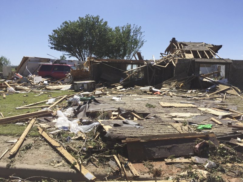
For the first time, the National Weather Service used a "Warn on Forecast" to notify emergency planners around Elk City, Oklahoma, that tornado warnings would likely be issued later in the day. Todd Lindley, the science operations officer at the Norman weather office, said the special weather advisory was essentially "forecasting that we would be issuing warnings."
Beckham County emergency managers started their sirens 30 minutes before the tornado hit. Currently, most communities receive about 13 minutes' notice that a tornado is on the way.
"This could open up a new door for a very detailed increased lead time," said Steve Koch, director of the National Severe Storms Laboratory. "That's the direction we're heading."
Computing power
Using computer models to predict weather is not new. General forecasts sent out every day are created with the help of computers, but detailed forecasts such as the one at Elk City require the researchers to run millions of calculations in a short period of time.
In addition to images from satellites, radar units and weather stations, "the one thing we need is computational power," Skinner said. In their work, the lab uses about 1.2 terabytes of bandwidth a day to ensure that modeling is done in a timely manner.
After all, if it takes 12 hours to run the various simulations, the storm will be gone before any prediction comes out.
"We aim to do this in a half-hour," Skinner said.
Will the approach
work with all storms?
The May 16 tornado formed from a classic supercell that formed in the relatively desolate Plains. Forecasting in other areas of the country might not be so easy because storms can form under several conditions such as cold fronts and sharp contrasts between dry and humid air.
After this year's experiment period was over, a tornado hit Jonesboro in northeastern Arkansas on July 3. It was never detected ahead of time.
"We had a little spin-up tornado that never showed up on the radar," said Jeff Presley, director of the E911 system in Jonesboro. "It got really dark. We anticipated roads getting flooded, then people started calling saying there were power outages, and trees down, then a roof off an apartment complex."
Such pop-up storms will often elude forecasters.
"Smaller storms like the 30-second tornado, that is an extremely big challenge," said Koch, the Severe Storms Laboratory director.
At a minimum, the researchers said they expect to do a better job reading the atmosphere ahead of a storm.
"It's not a game changer at this point because the system is still quite experimental, but it is a big step," Lindley said.
State Desk on 07/15/2017