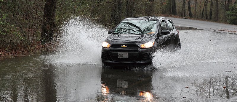
Creeks swelling with 2 to 3 inches of rain rose quickly Monday, but officials said the high water wasn't affecting area roads.
Hot Springs Public Works Director Denny McPhate said a U.S. Geological Survey flood warning gauge showed Gulpha Creek had risen to 5.35 feet Monday at the East Grand Avenue frontage road crossing. The east branch of the creek had risen almost 3 feet since Sunday, reaching 4.43 feet Monday afternoon, according to the Entergy Arkansas Inc. gauge at Bald Mountain Road.
Entergy's gauge at Sunshine Road showed Big Mazarn Creek had risen more than 6 feet since Sunday, reaching almost 7 feet Monday afternoon. The utility's gauge near South Moore Road recorded an almost 8-foot rise of Little Mazarn Creek since Sunday, climbing to near 10 feet Monday afternoon.
More than 3 inches of rain fell at the Big Mazarn Creek reporting station from Saturday to Monday afternoon, with 1.6 inches falling over that time at the Bald Mountain Road station. The airport at Hot Springs Memorial Field reported 1.06 inches Sunday.
Garland County Director of Emergency Management Bo Robertson said there were no reports of road flooding Monday, other than water topping the low-water crossing on Brady Mountain Cutoff in Royal. Robertson said it's common for water to top the crossing during rain events.
With wind gusts of up to 30 mph in today's forecast and the ground saturated with several inches of rain, Robertson said the county is bracing for downed trees on roadways and utility lines.
"There could be some power outages, and some roads temporarily closed," he said. "Those are things you get in these kinds of conditions."
Meteorologist Heather Cross at the National Weather Service's North Little Rock office said a cold front approaching from the west was expected to bring 1 to 1.5 inches of rain to Garland County late Monday and early Tuesday. She said the cold front that caused last week's precipitous drop in temperature stalled out over the state last weekend, putting most of central Arkansas under flood warning and watches.

"It provided a nice focus for rainfall," she said. "It just kind of stayed in placed the last day or so. That's what has allowed it to rain."
The National Weather Service put Garland County under a flood watch until Tuesday at midnight.
Siren sounds in error
The city said it suspects a malfunctioning ribbon cable caused the emergency siren near Crescent and Malvern avenues to accidentally go off Monday morning.
McPhate said siren vendor SafetyCom Inc. thinks a short in the ribbon cable used as a secondary connection to the siren caused the false alarm. The cable has been disconnected, he said. The city plans on disconnecting similar cables from other sirens.
The Crescent Avenue siren is one of the older units in the city's warning system. McPhate said newer sirens don't have the cables, and that all of them are radio controlled.
The siren went off at 8:03 a.m. and sounded for several minutes, the city said. It's one of 15 in the city limits. The Hot Springs Board of Directors approved a $77,184 contract with SafetyCom last week for two more sirens. The new units will be placed near the Highway 70 west bridge and Hot Springs Mall.
The city said two more sirens in the north and east areas of the city will cover all 35-square miles of the corporate limits. The city has used its stormwater fund to purchase 17 sirens since 2013.
Local on 02/12/2019