Outdoor writer and photographer Corbet Deary is featured regularly in The Sentinel-Record. Today, Deary takes readers on a jaunt around the north side of Lake Ouachita.
The northern half of Arkansas is blessed with crystal-clear rivers and streams cutting their way through a jagged substrate, producing an opportunity to experience beauty unsurpassed.
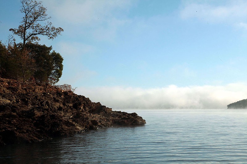
Many of these same waterways are responsible for the lakes that are utilized by millions throughout the seasons. These reservoirs vary in size. However, many of them are equally as scenic as are their tributaries, as they are contained by the same jagged substrate that is common throughout the Ouachitas and Ozarks.
We are fortunate in the sense that we have one of the most scenic lakes throughout the entire state right here in our backyard. Surrounded predominantly by national forest lands, Lake Ouachita sports in the neighborhood of 1,000 miles of shoreline and has a surface area of over 340,000 acres.
I would suspect that just about any outdoor enthusiast residing within the coverage area of The Sentinel-Record has spent their fair share of time on this beautiful body of water. However, I would also suspect that there are many who always return to the same location, and haven't seen the entire lake.
I, too, have my favorite access points, and for good reason. As an angler, I have learned, throughout the years, where I am most apt to experience the greatest success. It only makes sense to put in where one is closest to the waters where they choose to spend the day. But I have also learned which launching ramps are most boater friendly. In turn, these are the locations where I often choose to back my boat into the water, especially during those times when the lake level is either high or low.
Even those who have no intentions of changing locations still might find it enjoyable to see some of the less-popular recreation areas and access points scattered along the north side of the lake. That in mind, I thought this would prove a great time to embark upon a road trip to many of these spots.
We'll begin at Hot Springs and head north on Park Avenue to the intersection of Highway 7 where we'll take a left. Remain on the scenic highway for 10 miles and take another left onto Highway 298.
The road leading to Lena Landing, the first access point on the north side of the lake, is situated 10.9 miles from where we turned onto Highway 298. Simply take a left onto Rock Springs Road, travel just under a mile and turn left at the sign and follow the road a half-mile to the launching ramp.
Backtracking to Highway 298, turn left and remain in a westward direction for just under 2 miles and take a left onto Harpers Grocery Road. Remain on Harpers Grocery and take the second right onto Cedar Fourche Road. Remain on the dirt road until the route makes a hard left where we will continue straight at the sign.
Although there is no concrete launching ramp at this particular site, there is a dirt ramp that is utilized on a regular basis. This is also the only recreation area on the north side of the lake that sports a restroom with running water.
OK, let's backtrack to Highway 298 and continue west (left) for 3.9 more miles where we can take a left onto Buckville Road, which leads to three different access points. Rabbit Tail Road will be on the left, just past the store and will lead to the Rabbit Tail launching ramp. Continuing straight on Buckville Road, those wishing to visit the Avant launching ramp can take their first right after passing the store. Remain on the dirt road to an intersection where you will take a right and continue along the route to the ramp.
Continue straight on Buckville Road, 6 miles from the 298 intersection and take a right to enter the Buckville Recreation Area. Although fishing is good in this section of the lake, at times, it is important to mention that the launching site is pretty much unusable when the lake is low.
Now back to 298, where we'll make yet another left-hand turn and remain in a westward direction. For 3.7 miles, to the road leading to the Irons Fork Recreation Area. Turn left at the sign and follow the dirt road for about one mile, where it ends at the lake.
OK, guess what? You got it. Let's head back to 298 where we will make yet another left. But this time we'll travel 6.2 miles to the intersection of Highway 27. And once again, we'll take a left.
Remain on 27 for about five miles, to where the highway crosses the Ouachita River, travel four-tenths more miles and the road leading to the Highway 27 Recreation Area will be on the left. This is a quaint little spot with a launching ramp, situated just downstream from the aforementioned bridge.
Let's continue on Highway 27 for 2.7 more miles, where we will take a left onto Highway 188. Remain on the highway for about 7 miles and turn right, yep, we finally took a right, at the entrance of the Little Fir Recreation Area.
This is a spot where I have visited many times, in spite of the fact that it's a ways from where I live. In fact, I would say that Little Fir is one of my top four favorite access points. The launching ramp is well designed and boater friendly, and the fishing in the area is not bad, either.
I suppose we are ready to begin our journey back to Hot Springs. Backtracking to Highway 27, simply take a left and remain on the highway for nearly 5 miles to the Highway 270 intersection, at Mount Ida, where we will take a left.
The stretch of highway leading back to Hot Springs will make its way to several intersections leading to the lake, all of which are popular destinations. However, there is one spot alongside the highway which I would like to mention.
From Mount Ida, remain east on Highway 270 for 10 miles, and take a left onto Shangri-La Drive. Travel just a short distance and turn left into the parking area. This quaint little spot is an access point to the Lovit Trail.
But an ADA trail also begins at the restroom and makes its way through a beautiful natural area prior to making its way along a boardwalk overlooking a section of the lake. I realize that there is no launching ramp on site, nor is there a camping area. But this is certainly a special little spot.
This is by far, the most impressive ADA trail that I have visited throughout the entire state. In fact, those who chose to include this section of path into the trail system certainly have my admiration.
OK, back to the rig, and let's head home. Hopefully, this drive will prove enjoyable to those who decide to strike out and get better acquainted with the north side of Lake Ouachita. And who knows? You might just happen upon your future favorite spot.
