
A series of storms is forecast to move across the center of the country over the weekend, which could spoil views of Monday's total solar eclipse.
According to Chris Buonanno, the science and operations officer for the National Weather Service in North Little Rock, the local forecast is still in flux, but the organization is forecasting a 20% chance of rain after 1 p.m.
"Trying to specify and get that specific time range is not easy to do," he said. "Even as we get closer, I guess there is growing concern that sometime Monday night, there will be a chance for some strong to severe storms in parts of the state as well as some heavy rain, which will continue into Tuesday and even Wednesday. Forecast competence is increasing that some strong storms again, after the eclipse Monday night, Tuesday and then Wednesday."
The forecast also predicts some storms across the state over the weekend, although locally they are expected to bring little threat of severe weather.
Video not playing? Click here https://www.youtube.com/embed/S3wKzsbCw8M
"There's some chance late afternoon into the evening, with a better chance in eastern Arkansas," Buonanno said. "Hot Springs area, there's a small chance in the afternoon. Looks like the threat of the front moving through will be a small window. Hot Springs area, we'll see some chance of precipitation, better chances will be east of you."
Buonanno said the general dividing line between favorable and unfavorable viewing conditions lands between Little Rock and the Spa City.
"Our forecasts have been consistently showing chances for greater cloud cover as you go south and less cloud cover as you go north," he said. "I do expect a gradient of cloud cover from north to south across the state around eclipse time.
"The line between favorable conditions and unfavorable seems to be right near Little Rock to Hot Springs, unfortunately. That corridor can change; our forecast will likely change, but at this time, it's really a fine line between the favorable conditions and unfavorable conditions."
The difficulty of forecasting the weather for the eclipse is due to the small window of time, Buonanno said.
"This is a unique situation," he said. "There hasn't been, I can think of in my career, anytime we were trying to forecast to get this precision this far out and so forth."
Buonanno said different clouds will create different viewing conditions for the eclipse.
"I can tell you the nature of the clouds will affect the viewing, whether it be high cirrus, if that were overhead, that would provide some hindrance of the eclipse conditions," he said.
"Now if we had just simple cumulus, like if it was a day like (Friday) ... we would actually lose those clouds with the eclipse starting because you lose your solar insulation, which favors those clouds. They would go away by the time of the total eclipse going overhead."
While forecasting the exact nature of the clouds that could be in the sky Monday afternoon is not possible, Buonanno said that meteorologists found cumulus clouds tend to disappear during solar eclipses and return afterward.
"This far out we're not able to determine what kind of clouds we'll have," he said. "We noticed that in the eclipse in 2017, when the cumulus clouds disappeared, they came back after about two hours. This is a unique situation."
Buonanno said while there is a chance for some severe weather Monday afternoon through Wednesday, the biggest chances are in the southern part of the state.
"At this time it appears that the probabilities are greater for a heavy rain event," he said. "The severe chances looks like, in terms of the state, right now being limited to extreme southern portions of the state. But we are more worried at this time about the excessive rain, flash flooding kind of event on Monday night Tuesday to Wednesday."
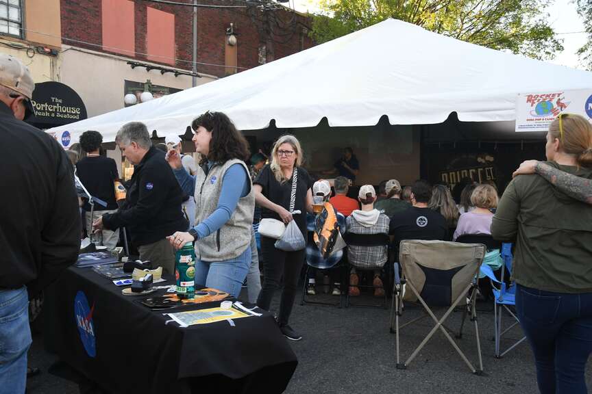 Attendees at Thursday's Bridge Street LIVE event had the opportunity to hear from scientists from NASA and the National Oceanic and Atmospheric Administration. There were also free items handed out during the event. (The Sentinel-Record/Lance Brownfield)
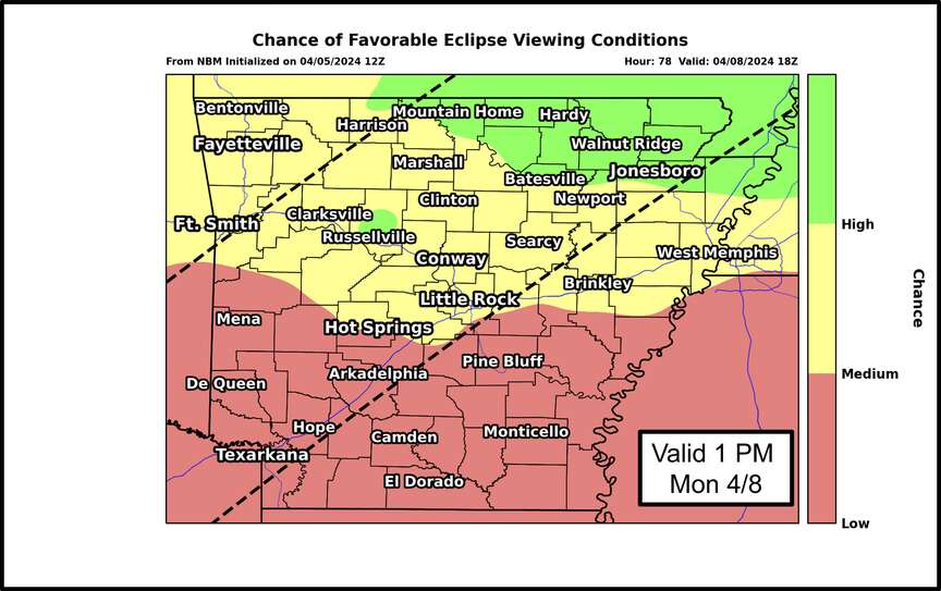 A map released by the National Weather Service in North Little Rock shows where viewing conditions for Monday's total solar eclipse are forecast to be best. Hot Springs is near the dividing line between medium and low visibility. (Submitted photo)