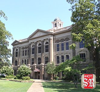
County Judge Rick Davis said keeping county employees off snow-slicked roads Tuesday morning informed his decision to close county offices.
The 1.1-inch accumulation, as reported by a National Weather Service observer in Jessieville, gave Davis reservations about employees negotiating treacherous spots reported on bridges and overpasses. The county's mass notification system sent out an alert at 5:27 a.m. that county offices would open at 10 a.m. before issuing the closing notice at 7:47 a.m.
Hot Springs city offices opened at 10 a.m.
"We kept thinking it would start to look better after the sun came out," said Davis, who began soliciting road reports from the Garland County Sheriff's Department, Arkansas State Police, school superintendents and city officials early Tuesday.
"But conditions stayed about the same. The majority of (employees) live a good distance away in the unincorporated area of the county. We took them getting into work safely and tearing up their vehicles into consideration. We didn't want to take a chance of getting employees hurt."
Some of the county's contract residential sanitation haulers tried to make a go of their Tuesday routes before begging off, Davis said, out of concerns for their equipment. He said garbage scheduled for Tuesday pickup will be collected today.
"They'll pick up Tuesday and Wednesday's routes (today)," he said. "The transport trucks won't go to Little Rock, so we'll have to catch up on that (today) too."
County Road Commissioner Tony Breshears said crews began salting and sanding county-maintained collector roads such as Amity, South Moore, North Moore and Blacksnake at 5 a.m. before moving on to less-trafficked roads with curves and hills, such as Grandstaff Drive in southern Garland County.
City street crews were called in Monday night and at the ready to apply a salt, sand and beet juice mixture once the fast-moving Arctic front had departed. Public Works Director Denny McPhate said crews manning seven trucks with plows and spreaders worked until 7 a.m. Tuesday.
Relief crews kept at it and began working on side streets later in the day. McPhate said the city applied its mixture to most of Malvern and Central avenues, with Arkansas Department of Transportation crews focusing on Albert Pike and Airport roads and the King Expressway and both the city and state working on Higdon Ferry Road.
McPhate said the city called in a night crew to clear up spots expected to refreeze late Tuesday and early today.
John Caldwell, the department of transportation's Garland County supervisor, said the state had four trucks working late Monday into Tuesday, first applying a pre-treating brine solution and then a rock salt-calcium chloride mixture after the snowfall ended. Caldwell said sand is added to the latter mixture to improve traction on troublesome spots.
Meteorologist Dennis Cavanaugh with the National Weather Service's Little Rock office said the 1.1 inches in Jessieville and a social media report of 1 inch 2 miles south, southeast of the Blue Springs community were the only accumulation reports available for Garland County.
He said the state's most significant snowfall came in the southeast and north central areas. The heaviest bands advanced along an axis from Camden to Pine Bluff, depositing 4 to 6 inches, he said. The Gamaliel community on the Missouri border and Mountain Home reported about 5 inches.
The Little Rock area reported 1 to 2 inches, and the Malvern area of Hot Spring County reported 3 inches. Western Hot Spring County reported 1.5 to 2 inches.
Cavanaugh said moisture from the Gulf of Mexico mingling with Arctic air generated the snowfall.
"Low-level Gulf moisture got wrapped into the system," he said. "It wasn't a ton of moisture, even though we got a decent amount of snow. The fact that there was no significant freezing rain or sleet means we didn't have any Pacific or upper level moisture. The Gulf moisture came through pretty fast with the Arctic air."
Cavanaugh said upper level low pressure moored over the northeastern part of the country and warm air in the West have allowed Arctic air to plunge as far south as the Gulf Coast, leading to the wind chill advisory issued Tuesday for Garland County.
"We've been in a favorable weather pattern for allowing Arctic air into the central part of the country," he said. "If the upper level low pressure moves away from the Northeast, it's a lot harder to get Arctic air in this part of the country."
The cold spell has so far defied a seasonal forecast that predicted above-average temperatures for December, January and February, but Cavanaugh said the forecast could still bear out if a warming trend takes hold.
"Even if we have a warm finish to January and a warm February, people will remember the really cold days," he said. "The snow and the cold stick with people."
Local on 01/17/2018